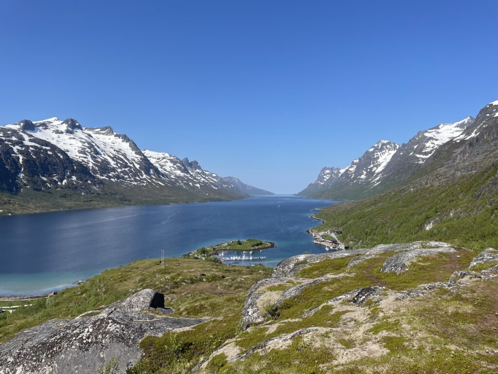
The landscape west of Tromsø is glacial. To conclude our days in Tromsø, we decided to hike up the 802 m high Buren, which is the easternmost peak of a mountain range in the north of the Erstfjord and the northern edge of the drowned trough valley (U-shaped valley). Today there is no recent glaciation here, but the traces of the last ice age are omnipresent:
Soon we cross a flat bog area that extends to the foot of the mountain, and then the trail climbs steeply, reaching the tree line after a short time. In the beginning of summer, due to the midnight sun and the great irradiation that comes with it, the snow fields melt quickly, so that small streams have to be crossed again and again.
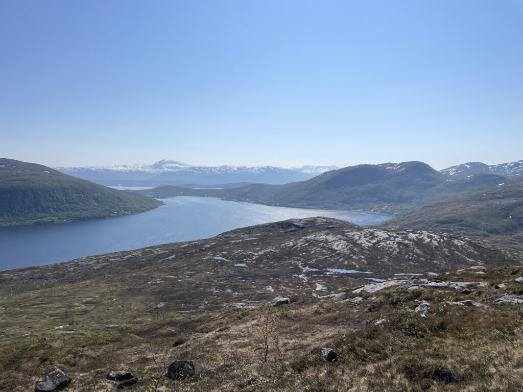
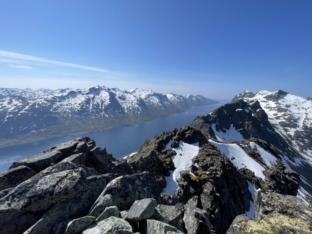
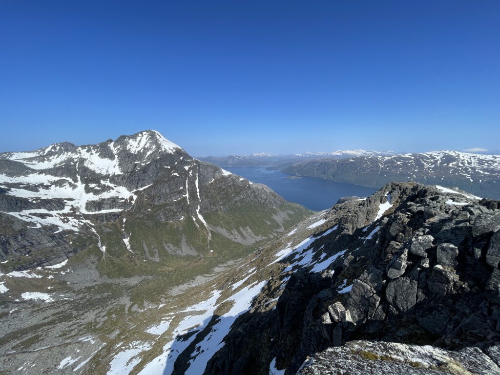
With increasing altitude above sea level, the grassy open landscape alternates with boulder fields, and finally the last part of the climb to the summit begins. The view down into the fjord and the adjacent formerly glacier-covered valleys is never ending. From the 802 m high summit, one overlooks the mountain range and a large part of the peninsula over an amphitheater of cirques with a cirque lake, the outflow of which drains north into the Kaldfjord. The landscape genesis is thus revealed form the peaks of the mountain range. These peaks protrude the ice stream network even in high glacial period, they formed pyramids, so-called Nunatakka, that topped the ice stream network.